Beijingwalker
VIP Member

Yadong and Chumbi Valley, A wedge stabbed into India and Bhutan in Tibet,China
Yatung and Chumbi Valley
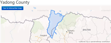
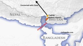
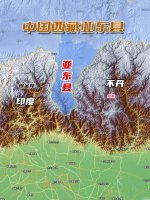
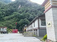
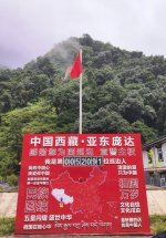
Yadong County is coextensive with the Chumbi valley that extends south into the Himalayas. It is located in the southern part of Shigatse Prefecture, Tibet, bordering Sikkim (India) to the west, Bhutan to the east , it also shares a border with Nepal. Its position along the Tibet-Nepal , Bhutan and India borders makes it a region of significant geopolitical and cultural importance.
Yadong is connected to the Indian state of Sikkim via the Nathu La pass.
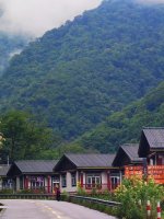
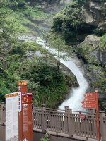
The Yadong County mainly consists of the Chumbi Valley, called Dromo/Tromo in Tibetan. The valley is bordered by Dongkya Range in the west and Massong-Chungdung range in the east.
Chumbi Valley
The Chumbi Valley in Tibet is of immense strategic importance to the PLA, since it can station troops there far from the harsh climate of the Tibetan Plateau. It can also threaten the Siliguri Corridor in India just over 50-km away.But the valley is also narrow and China may seek to obviate that by expanding into the Doklam Bowl on Bhutan’s western border. The India-China standoff in Doklam in 2017 comes to mind.
Stability can only be achieved if both sides continue to retain their existing vunlerabilities since any military confrontation could inadvertently escalate.
Importance of Doklam, Duktengang
The route to the Siliguri Corridor lies via Duktengang through the Doklam gateway. Thus the strategic importance of Doklam and Duktengang to India, is greater than what it means for Bhutan and even China. The security of the area is closely linked to the Siliguri Corridor in India.A word on the Doklam crisis of June 2017 would provide context here. China tried to build a road in the area towards Jampheri, thus unilaterally attempting to shift the India-Bhutan-China tri-junction from Batang La to Gyemochen.
Siliguri Corridor
Otherwise known as the Chicken’s Neck, the Siliguri Corridor runs 60-km north to south through the state of West Bengal connecting the northeastern states. It is 170-km wide bounded by Nepal, Sikkim and Bhutan in the north and Bangladesh to the south. At its narrowest, it measures 20-km by 22-km between Nepal and Bangladesh.The geography of the corridor is strategic: it comprises surface communication networks, power grids, oil pipelines, airports and so on, which makes it hugely vulnerable.
Its important to understand that along the entire Sino-Indian border, the risk of unintended escalation is highest in this area. The irony bears re-stating: there is no dispute between India and China here, the boundary dispute lies in a third country Bhutan, which makes things very tricky.