Pakistan Space Related News & Discussions

You haven't reached the ability to continuously track. For that, you need a constellation of satellites.

:ROFLMAO: :ROFLMAO: The desperation is so obvious. How many people in your wing are out sick due to this news of our Satellites?

We have a "constellation". Don't you worry. Try breaching the ceasefire line to find out. Last time you blamed China for supporting us to hide your beat down by Pakistanis. Who will you use for blame shift the next time? USA or KSA?
 
Only if you have a constellation of satellites

I have a SAR system connected with ground control with fiber optics. I tell it to take a picture of coordinate X,Y,Z, it does that and sends it to ground station right away. Why do I need a constellation? Especially when my area of need is covered by one Satellite? You clearly don't have a clue about how it works.

Stop making silly statements that have nothing to do with reality. A computer does its functions individually and in a network manner when need be. It's silly to make up propaganda Indian style and create a bullsh8 story to marginalize a system's effectiveness.

Very good. Hope you have excellent diplomatic and logistic coverage to maintain such "fiberoptics" across foreign lands to have such an ability.

Many countries should take your idea as an inspiration and feel ashamed for not getting such ideas.
 
The first deal involves a 2.9 billion yuan ($400 million) agreement between Chinese satellite company PIESAT and Pakistan to help develop an independent satellite network. This partnership will enable Pakistan to establish a dedicated satellite constellation for real-time communications and remote sensing.
 
Only if you have a constellation of satellites

That is coming

"Pakistan and China’s PIESAT signed a CNY 2.9 billion (~$400 m) pact to build a Pakistan-owned satellite constellation for real-time comms and remote sensing. Reports add that Phase 1 includes launching 20 satellites, building a satellite manufacturing facility in Pakistan, plus software and tech-transfer support so Pakistan can operate and develop satellites independently."
 
(Yicai) Sept. 5 -- Shares of Piesat Information Technology surged after the Chinese aerospace firm signed a CNY2.9 billion (USD406.4 million) agreement -- nearly double the company's total revenue last year -- with Pakistan to help build a satellite constellation for better communication and Earth data.

Piesat [SHA: 688066] jumped 15.2 percent to CNY36.28 (USD5.10) today, extending its year-to-date gain to nearly 80 percent.

The Henan province-based company signed the deal yesterday during the second Pakistan-China B2B Investment Conference in Beijing, according to an announcement today.

Under the agreement, Piesat will assist Pakistan in constructing an integrated satellite system for global real-time communication and remote sensing. The first phase includes the launch and operation of 20 satellites, the construction of a satellite manufacturing facility, and the development of supporting software. Piesat will also provide technical support to help Pakistan develop independent capabilities in satellite manufacturing, operations, and applications.

Founded in 2008, Piesat specializes in remote sensing and geospatial software and also operates satellites. It got listed on Shanghai’s Nasdaq-style Star Market in 2019 and moved its headquarters from Beijing to Hebi in central China last month.

Piesat is currently developing the Nuwa constellation, which aims to become China’s largest commercial radar remote sensing satellite network with 114 satellites. To date, 13 have been launched, providing real-time data for disaster prevention, natural resource management, and environmental monitoring.

Piesat has struggled in recent years due to a weak macroeconomic environment and a decrease in domestic orders. Its net loss widened nearly fourfold to CNY1.4 billion (USD196.2 million) last year, while revenue fell 13 percent to CNY1.6 billion.

In the first half of this year, the net loss increased by 34 percent year-on-year to CNY248 million (USD34.8 million), and revenue plunged 66 percent to CNY290 million, according to its latest financial report.
 
In a major step forward for Pakistan’s space program, SUPARCO is set to launch a state-of-the-art remote sensing satellite on July 31 . More in this report…


To view this content we will need your consent to set third party cookies.
For more detailed information, see our cookies page.


To view this content we will need your consent to set third party cookies.
For more detailed information, see our cookies page.

Brilliant. SAR is good.
 
The first deal involves a 2.9 billion yuan ($400 million) agreement between Chinese satellite company PIESAT and Pakistan to help develop an independent satellite network. This partnership will enable Pakistan to establish a dedicated satellite constellation for real-time communications and remote sensing.
as a step too late but in the right direction.
 
This series of Satellites will allow Pakistan to do its own imaging and analysis and not have to depend in BeiDou constellation 100%.
Since when has BeiDou started doing imaging and analysis?
Last known it was to provide navigation services.

@fitpOsitive, could you please throw some light on this aspect? I don’t trust Raja Babu, since he dishes out BS @ square of words used in a post.
 
Very good. Hope you have excellent diplomatic and logistic coverage to maintain such "fiberoptics" across foreign lands to have such an ability.

Many countries should take your idea as an inspiration and feel ashamed for not getting such ideas.
I feel you have a few loose screws. In fact, the majority of Indians seems suffering from the same deficiency.
 
On 05 September, China’s Yicai Global reported that PIESAT Information Technology Co. signed a USD $406 million deal with the Government of Pakistan to assist the latter build “an integrated satellite system for global real-time communication and remote sensing.”

In its first phase, the program will see the “launch and operation of 20 satellites, the construction of a satellite manufacturing facility, and the development of supporting software.” Overall, the goal of the program is to “help Pakistan develop independent capabilities in satellite manufacturing, operations, and applications.”

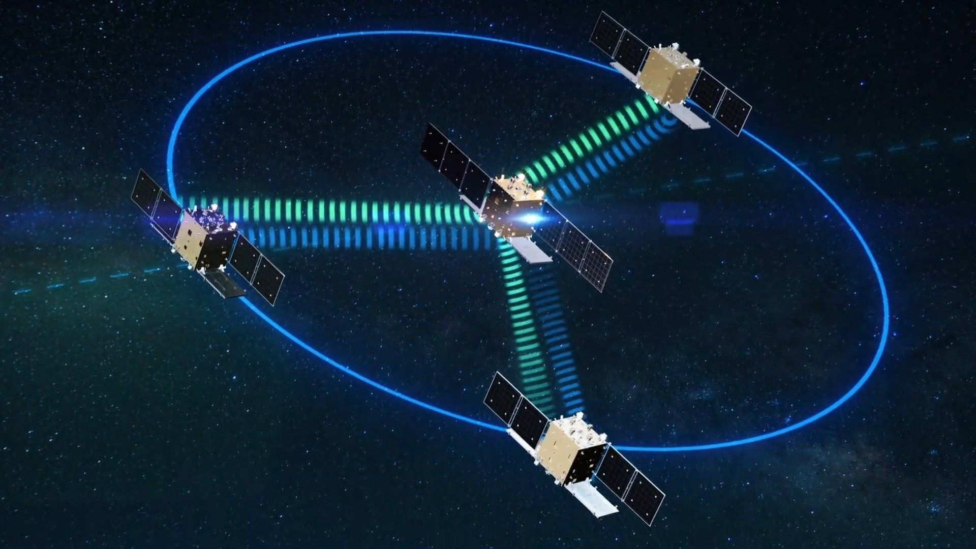
Founded in 2008 and listed on Shanghai’s Star Market in 2019, PIESAT’s flagship initiative is the new “Nuwa” constellation. Nuwa is slated to be China’s largest commercial synthetic aperture radar (SAR) network, with a target of 114 satellites, 13 of which have reportedly launched.

The Pakistan deal is valued at nearly twice PIESAT’s 2024 revenue, and given the softer domestic demand in the Chinese market in 2025, the contract could be a financial lifeline for PIESAT.

For Pakistan, the agreement aligns with its long-term aim to design, manufacture, and potentially launch satellites domestically. In 2021, the government earmarked funding for a feasibility study of a local production site, the Pakistan Space Centre (PSC). However, those studies did not materialize into an actual facility, much less any substantive large-scale satellite manufacturing work.

It now appears the PSC concept has been rolled into this PIESAT contract. If this is the case, this new contract compresses the multi-year learning curve by packaging transfer-of-technology (ToT), factory setup, and constellation deployment into a single, integrated program rather than ad hoc purchases.

The acquisition also speaks to capability gaps observed during Pakistan’s recent conflict with India, notably the absence of a strong, sovereign imaging intelligence (IMINT) pipeline for target selection and post-strike battle damage assessment (BDA).

The problem was not solely a lack of satellites; rather, it was unreliable access to cloud-free, daylight electro-optical (EO) imagery and delays between the tasking and delivery. SAR – i.e., PIESAT’s core offering – addresses both constraints by providing an all weather, all-day, and rapid IMINT capability by enabling frequent ‘refreshes’ of the battlefield picture.

In short, this reported deal signals three key shifts in Pakistan’s space development.

  • First, it is the clearest sign yet that Pakistan is decoupling SUPARCO from satellite procurement – and, in time, manufacturing. This follows a near-92% cut to SUPARCO’s annual budget (from USD $235 million in 2024–2025 to USD $19.5 million in 2025–2026).

    While this would shrink SUPARCO’s role in dual-use and defence-oriented space programs, it will also restore its original mandate to scientific research and economic applications. Hence, the acquisition of new satellites will be managed by a separate entity, likely from within the military’s structure.

  • Second, the Strategic Plans Division (SPD) would likely stand up a new entity to manage satellite acquisition and, eventually, production. PIESAT could support the SPD in building that organization’s assembly, integration, and testing (AIT) lines, quality assurance, and a rolling-refresh plan to sustain performance over the constellation’s life.

  • Third, the PIESAT package points to an ISR expansion with an emphasis on timely IMINT that can directly support Pakistan’s growing focus on preemptive strikes via Army Rocket Force Command (ARFC) and the Pakistan Air Force (PAF).
PIESAT specialises in remote sensing satellites with an emphasis on interferometric SAR (InSAR). With sufficient satellites, the company claims revisit rates of up to 60 minutes at sub-0.5 m resolution. In effect, Pakistan could generate fresh imagery within a 24-hour cycle, potentially up to within one hour in certain conditions.


Credit to @Quwa
 

Users who are viewing this thread

Pakistan Defence Latest

Country Watch Latest

Latest Posts

Back
Top