
Why India wants to develop high-altitude pseudo-satellite vehicles, powered by the Sun
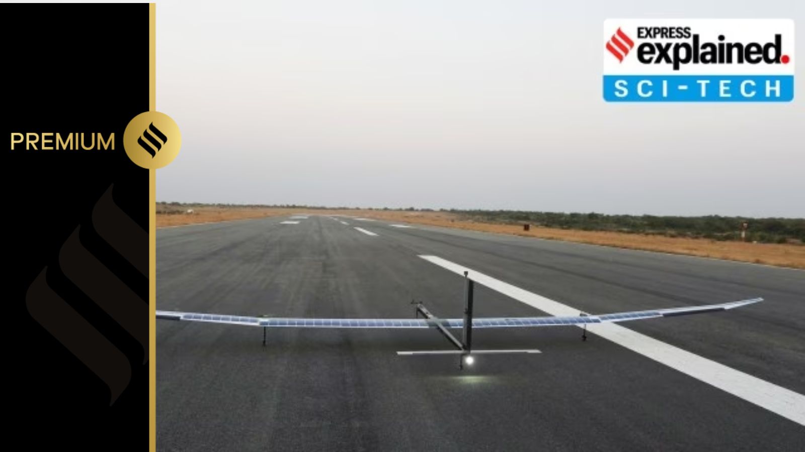
Last week, the Bengaluru-based National Aerospace Laboratories (NAL) successfully flew a prototype of a new-generation unmanned aerial vehicle (UAV) that is being seen as a huge technology breakthrough. It was no ordinary UAV. This one can fly at great heights, about 20 km from ground, runs entirely on solar power, and can remain in the air for months on end. Such UAVs belong to a class of flying objects called HAPS, or high-altitude pseudo-satellite vehicles, or HALE, that is high-altitude long-endurance vehicles.The primary utility of HAPS vehicles is in the field of surveillance and monitoring, but there are other situations, like disaster management, wherein it can be very useful.
HAPS technology is still under development. Several countries, and companies, have developed and flown such vehicles with encouraging success, but none has mastered the technology yet. The world record for a vehicle of this class is held by the Airbus-manufactured Zephyr, which flew continuously for 64 days in August 2022 before crashing.
The prototype tested by NAL last week spent eight and a half hours in the air. Next month, NAL, a unit of the Council of Scientific and Industrial Research (CSIR), plans to keep it in flight for at least 24 hours. The full-scale machine that NAL is trying to build, by 2027, would be aiming to remain in the air for 90 days at a stretch.
What is the need for such UAVs?
The kind of jobs that HAPS are meant to do are currently done by UAVs and satellites, but both have certain limitations. The normal UAVs, or drones as they are commonly called, are mostly battery-powered and cannot remain in the air beyond a few hours. Continuous monitoring is not something these can do very effectively. In addition, they fly at relatively low levels, because of which their vision is restricted to small areas.
Satellites can observe much larger areas, but the ones in low-earth orbits are continuously moving with respect to Earth. They cannot be constantly keeping an eye on the target area. Geostationary satellites, located at a height of about 36,000 km above the ground, can keep a constant gaze over one area. But these are fairly expensive, and once deployed, cannot be repurposed or reoriented.
HAPS are meant to overcome all these shortcomings, and do more.

“These stratospheric vehicles (flying about 20 km above the ground) are designed to loiter over a region. By standards of flying objects, and in comparison to UAVs for example, they move really slow, at just about 80-100 km per hour. That kind of slow speed 20 km above the ground means that objects on the ground pretty much don’t move for it. You can easily keep an eye over 200 sq km of area. In fact, you can observe everything even over a 400 sq km area with a five metre resolution. If you want to focus only at one sq km, for example, you can get a resolution as high as 15 cm,” said Dr L Venkatakrishnan, chief scientist and head of Experimental Aerodynamics Division at NAL, who is leading the development of HAPS.
“HAPS can be a very powerful solution for this kind of work. They work like geostationary satellites but with added flexibility. They can be easily redeployed over another location, or can be reequipped with a different payload, something that is not possible with a geostationary satellite,” Venkatakrishnan said.
Engineering challenges of HAPS
But developing an autonomous flying machine fuelled entirely by solar power and capable of remaining in the air for months faces major technological hurdles. That is the reason why, despite decades of work, a full-fledged HAPS vehicle has still eluded engineers. It is only now, with advanced technologies in solar cells, batteries and composite materials, that this vehicle looks possible in the near future.The primary challenge is to generate enough solar power to keep the aircraft flying, the payloads operating, and the batteries charging. The batteries need to be enough to continue the operations through the night. Then there are design-related challenges. The aircraft needs to be extremely lightweight to minimise the power requirement, but it also has to be stable.
This is one of the reasons why this aircraft is meant to fly in the stratosphere. The region between 17 and 23 km above the earth’s surface is climatologically conducive for their flight. The wind speed is very low and ideal for light-weight aircraft to remain stable. It helps that this height, much above the region in which civilian aircraft fly, is favourable for observation and surveillance activities.
This is one of the reasons why this aircraft is meant to fly in the stratosphere. The region between 17 and 23 km above the earth’s surface is climatologically conducive for their flight. The wind speed is very low and ideal for light-weight aircraft to remain stable. It helps that this height, much above the region in which civilian aircraft fly, is favourable for observation and surveillance activities.
But temperatures at that height can drop to -50 degree Celsius or lower. Electronics need to be kept warmer, and that is an additional burden on power resources. Also, air density is just about 7 per cent of what it is at sea level. That creates acute complications for the aircraft, for example in producing lift and thrust.
Because of limitations of space and weight, solar cells and batteries need to have very high efficiencies. For example, Venkatakrishnan said they were looking at battery cells with an energy density of 500 watt-hour/kg. Energy density is a measure of the amount of energy stored in a battery in proportion to its weight.
For perspective, an average truck battery has an energy density of 75 watt-hour/kg, most of the satellites sent by the Indian Space Research Organisation (ISRO) have batteries with an energy density of about 190-200 watt-hour/kg, and even Tesla, one of the most advanced car companies, was right now working with energy densities in the range of 240-260 watt-hour/kg, he said.
“With HAPS, we are testing the limits of present technology. There is one company which has achieved 500 watt-hour/kg, and the battery is commercially available, even though extremely expensive. Even with other aspects of this aircraft, for example, design, materials, aerodynamics and aeroelasticity, we are working at the limits of technology. HAPS is the grand engineering challenge of aviation right now,” Venkatakrishnan said.
India and the HAPS
For India, HAPS is another technology area where it is entering the race at a relatively early stage. In the last few years, there has been great emphasis on promoting research in emerging technologies, so that the country is not dependent on others for critical technologies of the future. Joining technology development at an early stage also results in capacity building, early adoption of technologies, control over patents, business opportunities and spin-off technologies.Venkatakrishnan said India had moved into HAPS technology development at the right time, and the successful test flight showed that it had capabilities similar to some of the other countries trying to develop this technology.
“We are not playing catch-up. We are not the leaders, for sure, at this moment, but we can confidently say that we have lead runners firmly in sight. We are very much in the race,” he said.
“For example, none of the advanced HAPS options, including Zephyr, has flown in tropical areas, which offer a much bigger challenge, because of the presence of jet streams in upper atmosphere. We probably have an advantage here,” he said.
Why India wants to develop high-altitude pseudo-satellite vehicles, powered by the Sun
For India, HAPS is another technology area where it is entering the race at a relatively early stage. The kind of jobs that HAPS are meant to do are currently done by UAVs and satellites, but both have certain limitations.


