Chinese scientists plan surface-to-air missile with 2,000km kill range

Hendarto

Full Member
Jan 11, 2024
427
273
Country of Origin
Country of Residence
Here is a good video as to the rationale for the extra-long SAM. Basically kicking the door with a stealth bomber allowing for a radar gap for the subsequent missile to pass through and hit valuable targets and military installation


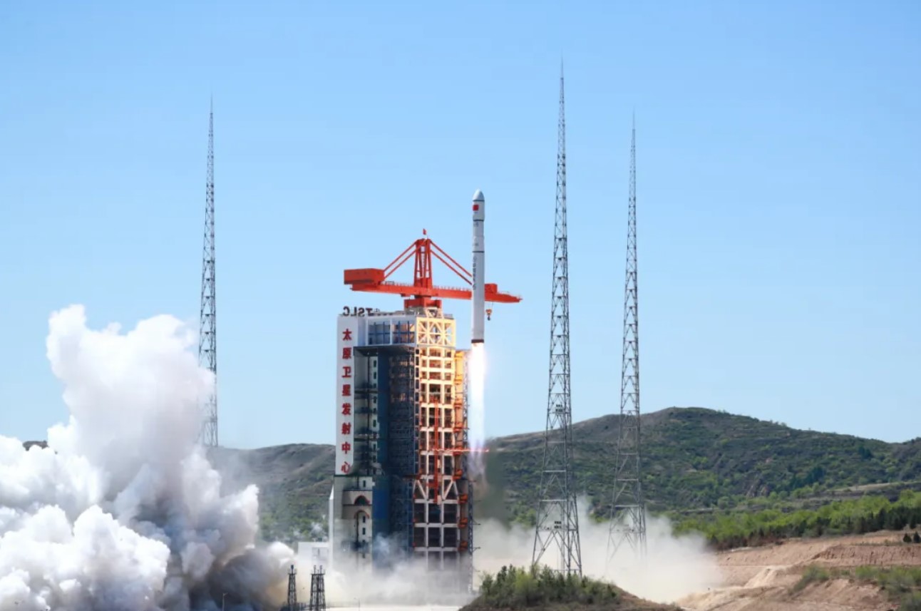
As a seasoned blogger, I am both impressed and alert to the emergence of China's super-long-range air defense missiles. This breakthrough not only showcases China's formidable military strength but also hints at potential shifts in future warfare dynamics. The potential challenge posed to the adversaries' strategy of "penetrating air superiority" when confronted with China's missile defense system could have profound implications for international military balance and regional security. However, as a blogger

As the international military landscape evolves, the contest for air superiority is becoming increasingly crucial strategically. The adversary's proposed strategy of "penetrating air superiority" aims to overcome the challenges posed by China's missile defense, but China's counterattack has demonstrated unexpected strength. In this contest of technology and strategy, how will both sides proceed with their next steps of confrontation? Does the emergence of China's super-long-range air defense missiles imply a gradual weakening of traditional air superiority? Faced with the rapid development of future military technologies, how will both sides respond to maintain their respective countries' security and interests? Think tanks of potential adversaries have long believed that potential confrontation with China is inevitable, with triggers possibly being the Taiwan Strait, the Korean Peninsula, or the South China Sea. Therefore, they have proposed the "penetrating air superiority" strategy against China.

Penetrating air superiority refers to... Potential adversaries have long regarded air control as a crucial condition for achieving operational victory. Traditional air control strategies typically involve using aircraft to remotely strike key targets such as enemy air defense positions, radars, and airfields to seize air superiority. From the Gulf War to the Kosovo War, and several other local conflicts, the crucial role of air superiority in achieving victory has been demonstrated. By gaining air superiority, potential adversaries have quickly achieved victory in wars, and armed aircraft have played important roles in conflicts in the Balkans, the Middle East, and South Asia.

However, potential adversaries have found that it is not feasible to use aircraft to remotely strike important targets in mainland China. This is because China possesses the most diverse range of missiles globally, especially in new combat capabilities such as electronic warfare, cyber warfare, space warfare, and anti-satellite warfare, where China even surpasses potential adversaries, especially in electronic warfare technology. If engaged in conflict with China, potential adversaries would face difficulties penetrating and operating. Therefore, potential adversaries have proposed the new "penetrating air superiority" strategy.
 

Hendarto

Full Member
Jan 11, 2024
427
273
Country of Origin
Country of Residence
Tracking objects is very easy. Search Radar is the real challenge.
If you can track, you know the coordinate and can feed the missile with the data . Anyway China just launched an experimental SAR satellite in the X-band

China launches first Long March 6C rocket​

Andrew JonesMay 7, 2024
The first Long March 6C rocket rises from the tower, May 7 (UTC), 2024, carrying four satellites into orbit. Credit: Ourspace
HELSINKI — The new Long March 6C rocket successfully inserted four satellites into orbit late Monday on its debut flight.

The first Long March 6C rocket lifted off from Taiyuan Satellite Launch Center, north China, at 11:21 Eastern, May 6 (0321 UTC on May 7). The Shanghai Academy of Spaceflight Technology (SAST), the rocket’s manufacturer, confirmed launch success within an hour of liftoff.

Four satellites were aboard the launch. The main payload was Haiwangxing-1, or Neptune-1, an experimental, 239-kilogram X-band synthetic aperture radar satellite. Neptune-1 was manufactured by SAST for Zhihui Space Tech. The latter firm aims to launch 12 operational satellites for the Neptune constellation.

The other satellites included Zhixing 1C, another SAR satellite, this time for Beijing-based Smart Satellite. The other two are described as wide-view optical and high-resolution video satellites. The mission was a SAST rideshare launch.

The new, 43-meter-tall rocket is the latest in a line of new-generation rockets developed by SAST designated in the Long March 6 series.
The Long March 6C appears as a shorter variant of the 50-meter-tall Long March 6A without the latter’s four solid rocket boosters. The rocket is capable of lifting about 2,400 kgs to a 500-kilometer Sun-synchronous orbit (SSO). The 6A can carry 4,500 kg to a 700-km SSO. The variants provide greater launch options and flexibility
 

Hendarto

Full Member
Jan 11, 2024
427
273
Country of Origin
Country of Residence
Here is the detail of Neptune 1 satellite It can track slow-moving target

Neptune-01 satellite sent into space by China’s new Long March-6C rocket​

Storyline​


Neptune-01, the first satellite of a radar constellation using parabolic antenna to image the Earth in space, was sent into planned orbit on Tuesday by China's Long March-6C in the new rocket's maiden flight.

The Neptune-01 satellite carries an umbrella-shaped antenna with an unfolded diameter of about four meters, which is a core device for Earth imaging.

Different from cameras of optical remote sensing satellites, the parabolic antenna emits electromagnetic waves to the Earth, and then receives and analyzes the electromagnetic waves reflected from the Earth to obtain radar images that contain a large amount of information.

"The satellite has the ability to image in a 24-hour and all-weather manner. This means that day or night, even in cloudy, rainy and sandy days, we can still use it to image," said Xiao Dengjun, payload chief designer of the satellite.

Boasting such capability, Neptune-01 can serve in land resources monitoring, disaster prevention and mitigation, environmental protection, maritime safety and other fields.

In addition to functions of traditional radar satellites, Neptune-01 can also determine the direction of slow-moving targets by taking videos.


"The satellite can grasp the dynamic characteristics of the target in a short period of time. This is very useful. For example, it's vital for traffic and port management," said Ren Wei, technical director of the satellite project.

The Neptune constellation initially plans to launch 13 satellites in orbit to form a network, which will greatly improve the response capabilities of the satellites upon its completion, according to Yao Xingfu, person in charge of the Neptune-01 satellite project.

"The second phase will be completed in 2028, with 36 satellites in orbit to provide high-resolution intelligent remote sensing services for the users," Yao said.

The Long March-6C carrier rocket blasted off at 11:21 (Beijing Time) from the Taiyuan Satellite Launch Center in north China's Shanxi Province, sending Neptune-01 and Smart-1C, as well as a wide-band optical satellite and a high-resolution video satellite into planned orbits.
 

Hendarto

Full Member
Jan 11, 2024
427
273
Country of Origin
Country of Residence
Here is the video of Neptune constellation consists of 38 satellite and should be completed by 2028
 

Hendarto

Full Member
Jan 11, 2024
427
273
Country of Origin
Country of Residence
I copy Beijing walker post here

China's Military Satellites Are Watching America's Every Move​

Published May 08, 2024 at 8:07 AM EDT

China's Satellite Launch From Xinchang Launch Center

A Long March 3B rocket carrying the Beidou-3GEO3 satellite lifts off from China on June 23, 2020. China is challenging the U.S. monopoly on satellite tracking capability, a senior Space Force official said. STR/AFP VIA GETTY IMAGES


China is fast challenging the United States' monopoly in space as new remote-sensing satellites have allowed Beijing to monitor American military assets globally.

"The PLA has rapidly advanced in space in a way that few people can really appreciate," Major General Gregory J. Gagnon, the Space Force's deputy chief of space operations for intelligence, said at the Mitchell Institute for Aerospace Studies on May 2.

The Space Force, established by former President Donald Trump, faces challenges posed by China's rapidly transforming space capabilities.

Space has emerged as a contested domain integral to modern military operations, as countries have sought to track each other's military assets from space. Military strategists believe satellites and space-based weapons could be used to fire the first shot in future conflicts. Satellites could be used to jam an opponent's signals during an escalation of military tensions.

China established its version of the Space Force in 2015, which was placed under the hierarchy of the People's Liberation Army's Strategic Support Force (SSF). Chinese President Xi Jinping dissolved the SSF last month, and a new force called the Information Support Force was constituted to merge the SSF's existing remit with it.

China has added over 400 satellites in the past two years, from which more than half have the capability to track objects on Earth, Gagnon said at the Mitchell Institute.

"They will now—in a way that we're not comfortable talking about in America—they will be inside a rapidly expanding weapons engagement zone," Gagnon added.

Gagnon explained that China can now track U.S. military assets even when they are mobile, challenging U.S. monopoly on long-range targeting. The data collected by China's satellites can provide a precise location of military vessels on the move at sea, making their subsequent targeting during conflict easier, according to Gagnon.

"Few countries have that advantage," Gagnon said.

Newsweek reached out to the Chinese Foreign Ministry, the U.S. Space Force and the U.S. State Department for comment via email.

This isn't the first time a senior U.S. Space Force official has warned about China's growing space capability.

General Bradley Saltzman, Chief of Space Operations at the U.S. Space Force, recently raised an alarm about China's exponential growth in satellite-based surveillance capability.

"The PRC has more than 470 [intelligence, surveillance, and reconnaissance] satellites feeding a robust sensor-shooter kill web," Saltzman said in March at the Mitchell Institute's Spacepower Security Forum, according to Air & Space Forces Magazine.

The rapidly declining cost of satellite launches has also spurred a revolution in China's private satellite companies launching new satellites. Chinese companies can now share near-accurate satellite imagery of U.S. military assets on land and at sea.

In 2023, Chinese companies launched 120 commercial satellites, which made up 54 percent of all satellites sent into orbit last year, according to China's state-run news agency Xinhua.

Mino Space, a Beijing-based satellite company, recently published the images of the U.S. Norfolk Naval Base captured with its Taijing 4-03 satellite. Mino Space has emerged as a leading Chinese satellite imagery provider that occasionally showcases its satellite capability by publishing the latest visuals of U.S. military bases and assets.

Mizar Vision, a Chinese satellite imagery provider launched in 2021, has been sharing daily satellite imagery of the military assets participating in the U.S.-Philippines joint exercise, Balikatan, over the past weeks on X-like Chinese social media platform Weibo.

Mizar is closely tracking the movements of the USS Theodore Roosevelt aircraft carrier, currently deployed in the South China Sea for joint exercises with the Philippines. It has also shared imagery of military activity around Taiwan and Japan over the past weeks.

Source:
https://www.newsweek.com/china-military-satellites-space-tracking-conflict-1898177
 

Users who are viewing this thread

Top