Pakistan Space Related News & Discussions

2025: A breakthrough year for Pakistan’s space ambitions

  • Plans are in place to send Pakistan’s first astronaut to a Chinese space station in 2026 and to land a rover on the moon by 2028
Baseer Ahmed
Published January 5, 2026


1767799654136.jpeg

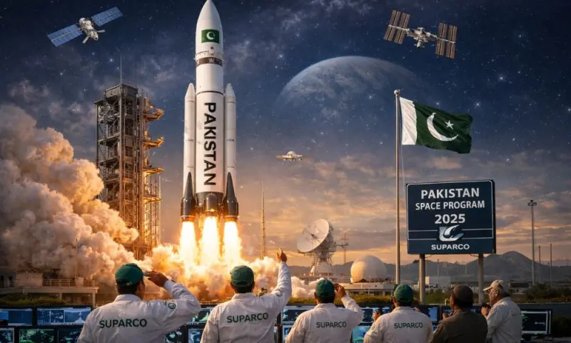
The year 2025 will be remembered as a defining chapter in Pakistan’s scientific and technological journey, as the country made decisive strides in space research and satellite technology. From the successful launch of multiple advanced satellites to the announcement of an astronaut and lunar rover programme, Pakistan’s space sector entered a new phase of ambition and global relevance.

According to Pakistan Space and Upper Atmosphere Research Commission (SUPARCO) Director Shafaat Ali, 2025 laid the groundwork for even more ambitious milestones ahead.

With plans already in place to send Pakistan’s first astronaut to a Chinese space station in 2026 and to land a Pakistani rover on the moon by 2028, the country’s gaze is now firmly fixed beyond Earth’s orbit — backed by close collaboration between the Pakistani and Chinese governments.

READ MORE: Pakistan successfully launches remote sensing satellite

A central highlight of 2025 was the launch of three major Pakistani satellites, bringing the total number of Pakistan’s operational satellites in space to seven.

In January, Pakistan launched its first-ever electro-optical satellite, PRSC-EO1, from China.
Developed under the auspices of SUPARCO, the satellite is designed to enhance Pakistan’s ability to monitor and manage natural resources, respond effectively to natural disasters, and improve urban planning and agricultural development. Electro-optical satellites collect detailed images of the Earth by detecting reflected sunlight or emitted radiation, making them a cornerstone of modern Earth observation systems.

The launch came at a time when the global Earth observation satellite market — currently valued at around $5 billion — is one of the fastest-growing segments of the commercial space industry. Forecasts by Novaspace suggest the market could exceed $8 billion by 2033, driven by growing demand for climate monitoring, urban mapping, and precision agriculture. Major space-faring nations, including the United States, China and India, continue to expand their satellite constellations, while private players such as Indian startup Pixxel have also entered the race.

In July, SUPARCO launched another advanced remote sensing satellite from a Chinese launch centre. According to a Foreign Office spokesperson, the satellite provides high-resolution, round-the-clock imaging, significantly strengthening Pakistan’s capabilities in urban planning, infrastructure development, disaster management and mitigation, agricultural monitoring, food security, environmental protection, deforestation tracking, climate change analysis, and water resource management.

Launched in collaboration with the China Electronics Technology Group Corporation (CETC) and MICROSAT China, the satellite represents a cornerstone of an integrated Earth observation system. Officials noted that it will play a critical role in supporting sustainable socio-economic development and improving quality of life across the country.

READ MORE: Pakistan’s first Hyperspectral Satellite launched into orbit from China

The momentum continued in October with the launch of Pakistan’s first hyperspectral satellite, HS-1—a major technological leap for the national space programme.
Equipped with cutting-edge hyperspectral imaging technology, HS-1 is capable of capturing data across hundreds of narrow spectral bands, enabling highly precise analysis of land use, vegetation health, water resources, and urban development.

The satellite is expected to significantly bolster national capabilities in precision agriculture, environmental monitoring, urban planning, and disaster management. Its high-resolution data will also enhance Pakistan’s resilience to climate-related challenges and support large-scale development initiatives such as the China–Pakistan Economic Corridor (CPEC) by identifying geo-hazard risks and enabling more sustainable infrastructure planning.

Beyond satellite launches, 2025 also saw the formal launch of Pakistan’s Astronaut Programme — another landmark achievement. Pakistan’s first astronaut is scheduled to travel to a Chinese space station in 2026, marking the country’s human entry into space exploration.

In parallel, Pakistan initiated its Rover Programme, signalling its intent to establish a presence on the Moon. The Pakistani-manufactured rover is expected to land on the lunar surface in 2028, with technical assistance from China. The initiative places Pakistan among a small group of nations planning active participation in lunar exploration.

Collectively, these achievements underscore the depth of long-standing cooperation between Pakistan and China in the peaceful use of outer space. More importantly, they reaffirm SUPARCO’s stated commitment to harnessing space technology for national development, climate resilience, and socio-economic progress.

As 2025 completes, Pakistan’s space sector stands transformed—no longer limited to isolated missions, but increasingly defined by long-term planning, advanced technology, and a clear vision that extends from Earth observation to human spaceflight and lunar exploration.

 
How many operational satellites does Pakistan currently have?

What's the developmental status of Pak's own satellite launch capability?
It's probably not in the interest of Pakistan to do this anytime soon. Even if they have the capability, they might be better off doing it in China.

SLV use similar tech as ICBMs, which will attract some significant US pressure. Flying under the radar is probably the best approach right now.
 
To view this content we will need your consent to set third party cookies.
For more detailed information, see our cookies page.
 
To view this content we will need your consent to set third party cookies.
For more detailed information, see our cookies page.
 
To view this content we will need your consent to set third party cookies.
For more detailed information, see our cookies page.
 
SUPARCO proposes AI solutions for ports to monitor cargo dwell time and improve customs efficiency
Maritime affairs minister calls for advanced space-based monitoring systems for enhancing maritime management and addressing environmental threats

By News Desk

1769463707384.jpeg

The Pakistan Space and Upper Atmosphere Research Commission (SUPARCO) has offered to develop artificial intelligence-based solutions for ports, including systems to monitor cargo dwell time and address customs-related inefficiencies through the Artificial Intelligence Maritime Secretariat (AIMS), established at the Ministry of Maritime Affairs.

Federal Minister for Maritime Affairs Muhammad Junaid Anwar Chaudhry, on Wednesday, emphasized that advanced space-based monitoring systems could play a crucial role in safeguarding seas, improving maritime management, and strengthening responses to environmental threats.

Chaudhry made these remarks during a visit to the headquarters of SUPARCO, marking the first-ever such visit by any maritime affairs minister in the country. During the visit, Chairman SUPARCO Yusuf Khan and senior officials provided the minister with a detailed briefing on the organization’s operations and technological capabilities. The discussions focused on SUPARCO’s role in satellite monitoring, maritime safety, and port management.

The minister was presented with a satellite-based assessment of potential sites for new ports, reflecting Pakistan’s focus on expanding its maritime infrastructure. Additionally, officials outlined plans for relief and rescue operations within national maritime boundaries, leveraging satellite technology and artificial intelligence to enhance efficiency and response times.

Addressing the participants, Junaid Chaudhry emphasized the importance of using satellite technology to tackle environmental and ecological challenges, including the impacts of climate change and disaster risks facing the country’s coastline and maritime sector. He stressed the need to conserve ocean biodiversity, ensure the sustainable use of marine resources, and enhance cooperation on marine environmental protection. He noted that Pakistan is working to align its national maritime policies with global conservation commitments.

The minister highlighted the increasing importance of protecting marine life, particularly in areas beyond national jurisdiction. He also pointed out that Pakistan is a member of the Ocean Biodiversity Treaty, supporting international efforts to protect ocean ecosystems and ensure the long-term sustainability of marine resources.

During the briefing, SUPARCO officials proposed developing AI-based solutions for ports, including systems to monitor cargo dwell time and address customs-related inefficiencies through AIMS. The meeting also explored ways to institutionalize cooperation between the ministry and SUPARCO. Chaudhry announced that a formal signing ceremony would be held to systematize collaboration and provide a structured framework for joint initiatives. Both sides agreed to appoint focal persons to expedite coordination and implementation of agreed projects.

SUPARCO officials highlighted the organization’s role in space science and satellite technology, with particular emphasis on maritime applications. They briefed the minister on the use of high-resolution satellite imagery and digital modeling to monitor mangroves, track maritime traffic, and detect oil spills along the coast.

The minister was also informed about SUPARCO’s capabilities in cyclone and storm surge hazard detection through coastal storm surge modeling. Chaudhry praised the agency’s contribution to disaster management, noting that early warning systems could help alert coastal communities ahead of severe weather events, potentially saving lives and reducing economic losses.

Chaudhry further lauded SUPARCO’s participation in the international Cospas-Sarsat program, which provides satellite-based search and rescue services. He stated that Pakistan could gain further benefits by integrating beacon-based systems into maritime operations to enhance safety and emergency response at sea.

In addition, SUPARCO briefed the minister on urban flood hazard modeling and its potential integration into future planning for coastal and port safety. Officials noted that continuous monitoring systems could help address coastal pollution, seawater intrusion, and broader environmental compliance challenges.

“We can benefit from continuous monitoring of coastal ecosystems to assess water quality, sediment dispersion, and overall environmental health,” the minister said, adding that data-driven approaches were essential for informed policymaking in the maritime sector.

The minister concluded by noting that Pakistan’s coastline is increasingly vulnerable to climate-related threats, such as rising sea levels, coastal erosion, and extreme weather. He emphasized the importance of stronger collaboration between maritime authorities and scientific institutions.

 
SUPARCO proposes AI solutions for ports to monitor cargo dwell time and improve customs efficiency
Maritime affairs minister calls for advanced space-based monitoring systems for enhancing maritime management and addressing environmental threats

By News Desk

View attachment 174954

The Pakistan Space and Upper Atmosphere Research Commission (SUPARCO) has offered to develop artificial intelligence-based solutions for ports, including systems to monitor cargo dwell time and address customs-related inefficiencies through the Artificial Intelligence Maritime Secretariat (AIMS), established at the Ministry of Maritime Affairs.

Federal Minister for Maritime Affairs Muhammad Junaid Anwar Chaudhry, on Wednesday, emphasized that advanced space-based monitoring systems could play a crucial role in safeguarding seas, improving maritime management, and strengthening responses to environmental threats.

Chaudhry made these remarks during a visit to the headquarters of SUPARCO, marking the first-ever such visit by any maritime affairs minister in the country. During the visit, Chairman SUPARCO Yusuf Khan and senior officials provided the minister with a detailed briefing on the organization’s operations and technological capabilities. The discussions focused on SUPARCO’s role in satellite monitoring, maritime safety, and port management.

The minister was presented with a satellite-based assessment of potential sites for new ports, reflecting Pakistan’s focus on expanding its maritime infrastructure. Additionally, officials outlined plans for relief and rescue operations within national maritime boundaries, leveraging satellite technology and artificial intelligence to enhance efficiency and response times.

Addressing the participants, Junaid Chaudhry emphasized the importance of using satellite technology to tackle environmental and ecological challenges, including the impacts of climate change and disaster risks facing the country’s coastline and maritime sector. He stressed the need to conserve ocean biodiversity, ensure the sustainable use of marine resources, and enhance cooperation on marine environmental protection. He noted that Pakistan is working to align its national maritime policies with global conservation commitments.

The minister highlighted the increasing importance of protecting marine life, particularly in areas beyond national jurisdiction. He also pointed out that Pakistan is a member of the Ocean Biodiversity Treaty, supporting international efforts to protect ocean ecosystems and ensure the long-term sustainability of marine resources.

During the briefing, SUPARCO officials proposed developing AI-based solutions for ports, including systems to monitor cargo dwell time and address customs-related inefficiencies through AIMS. The meeting also explored ways to institutionalize cooperation between the ministry and SUPARCO. Chaudhry announced that a formal signing ceremony would be held to systematize collaboration and provide a structured framework for joint initiatives. Both sides agreed to appoint focal persons to expedite coordination and implementation of agreed projects.

SUPARCO officials highlighted the organization’s role in space science and satellite technology, with particular emphasis on maritime applications. They briefed the minister on the use of high-resolution satellite imagery and digital modeling to monitor mangroves, track maritime traffic, and detect oil spills along the coast.

The minister was also informed about SUPARCO’s capabilities in cyclone and storm surge hazard detection through coastal storm surge modeling. Chaudhry praised the agency’s contribution to disaster management, noting that early warning systems could help alert coastal communities ahead of severe weather events, potentially saving lives and reducing economic losses.

Chaudhry further lauded SUPARCO’s participation in the international Cospas-Sarsat program, which provides satellite-based search and rescue services. He stated that Pakistan could gain further benefits by integrating beacon-based systems into maritime operations to enhance safety and emergency response at sea.

In addition, SUPARCO briefed the minister on urban flood hazard modeling and its potential integration into future planning for coastal and port safety. Officials noted that continuous monitoring systems could help address coastal pollution, seawater intrusion, and broader environmental compliance challenges.

“We can benefit from continuous monitoring of coastal ecosystems to assess water quality, sediment dispersion, and overall environmental health,” the minister said, adding that data-driven approaches were essential for informed policymaking in the maritime sector.

The minister concluded by noting that Pakistan’s coastline is increasingly vulnerable to climate-related threats, such as rising sea levels, coastal erosion, and extreme weather. He emphasized the importance of stronger collaboration between maritime authorities and scientific institutions.

This might be laterally away from SUPARCO's core mission, but it would be interesting and immensely useful if SUPARCO invested in foundational LLM research/development.

We need a national entity to build the infrastructure (data centers, energy, etc), data science, and research bodies to build our own national model. Thinking 3-5 years from now, we can't have every Pakistani AI-based or AI-powered initiative piping through a US LLM. From basic data annotation to more complex inputs, we have a massive and available labour pool (incl. uni grads) to do training.
 
To view this content we will need your consent to set third party cookies.
For more detailed information, see our cookies page.
 

Two Pakistani candidates shortlisted to train for China space station mission


News Desk Published February 7, 2026

1770465498729.png

Prime Minister Shehbaz Sharif witnesses the exchange of an agreement between Suparco and the China Manned Space Agency in Islamabad on Feb 28, 2025. — PID

Two candidates have been shortlisted for Pakistan’s Human Spaceflight Programme by the Astronauts Centre of China (ACC), the Inter-Services Public Relations (ISPR) said on Saturday.

In February 2025, Pakistan’s Space and Upper Atmosphere Research Commission (Suparco) and China Manned Space Agency (CMSA) had signed a cooperation agreement. Under the pact, two Pakistanis would train in China, with one joining a mission on the Tiangong space station operated by Beijing.

In a press release, the ISPR said Suparco had “achieved yet another significant milestone in Pakistan’s Human Spaceflight Programme with the successful completion of the secondary phase of astronaut candidates’ selection”.

“Following an initial screening process in Pakistan, the candidates were shortlisted after undergoing comprehensive medical, psychological, and aptitude assessments conducted at the Astronauts Centre of China (ACC), in accordance with international human spaceflight standards,” the statement read.

As per the bilateral agreement, the two shortlisted candidates will undertake “advanced astronaut training” for six months at ACC. Upon completion of the training, one candidate will be selected for a spaceflight mission aboard the Tiangong space station in October / November 2026, the press release added.
 
The ISPR noted the cooperation was anchored on the bilateral “Astronaut Cooperation Agreement” signed in February 2025 “under the leadership of Prime Minister Shehbaz Sharif, “whose vision and support were instrumental in enabling Pakistan’s participation in human spaceflight”.

“This landmark initiative also reflects the strong support of the Government of the People’s Republic of China, which selected Pakistan as the first foreign partner in its astronaut programme,” the ISPR highlighted.

At the February 2025 signing ceremony of the cooperation agreement, PM Shehbaz had said that Islamabad, in collaboration with Beijing, would send its first manned space mission to China’s space station.

The CMSA later confirmed that two Pakistani astronauts would be trained in China, with one expected to join a future mission to the Tiangong space station as a payload specialist.

CMSA spokesperson Lin Xiqiang said the selected astronaut would conduct scientific experiments on behalf of Pakistan while also performing standard crew duties aboard the station.

He noted that the said the selection would follow the same three-stage process (preliminary, secondary, and final) used for Chinese astronauts.

China has been barred from participating in the International Space Station since 2011, when the US prohibited Nasa from collaborating with Chinese space agencies. Since then, Beijing has sought to build partnerships with other countries — including Pakistan — in its expanding space programme.
 
Jiuquan: Pakistan's PRSC-EO1 satellite was launched successfully!

At 12:07 on January 17, 2025, the Long March 2D carrier rocket ignited and launched at the Jiuquan Satellite Launch Center, sending Pakistan's PRSC-EO1 satellite into the predetermined orbit. The launch mission was a complete success.

China Great Wall Industry Corporation (Great Wall Company), a subsidiary of China Aerospace Science and Technology Corporation, and Pakistan's Space and Extraordinary Research Commission (SUPARCO) signed a multiple launch service contract for Pakistan's remote sensing satellite constellation in 2022. The international launch service team of Great Wall Company innovatively adopted a mixed international and domestic carpooling method to design a launch plan that combines technical reliability and commercial competitiveness. It stood out in the fierce international competition and eventually won the favor of Pakistan. The Pakistan PRSC-EO1 satellite launched this time is the first satellite of the remote sensing satellite constellation planned by SUPARCO. The constellation currently plans a total of 3 optical remote sensing satellites, all of which will be provided with launch services by Great Wall Company. In addition, Great Wall Company also undertook the launch and orbital measurement and control guarantee mission of the PRSC-EO1 satellite.

Pakistan's PRSC-EO1 satellite was developed by SUPARCO. The satellite is equipped with a high-resolution optical payload. The remote sensing data obtained will serve Pakistan's land surveying, agricultural classification assessment, urban and rural planning, environmental monitoring, natural disaster monitoring and management, surveying, natural resource protection and other fields.

This mission also carried the Tianlu-1 satellite developed by Galaxy Aerospace Technology (Anhui) Co., Ltd. for the Jianghuai Frontier Innovation Technology Center, and the Blue Carbon-1 satellite (Hangzhou Dianzi Zhisuan-1 satellite) developed by Zhejiang Space-Time Daoyu Technology Co., Ltd. for Hangzhou University of Electronic Science and Technology

Pakistan is the country with the longest history of cooperation with my country in the field of aerospace and the most extensive fields. The successful implementation of the PRSC-EO1 satellite project is another milestone in the cooperation between China and Pakistan in the field of aerospace. It is not only a vivid manifestation of the friendship between China and Pakistan, but also a concrete practice of the community of shared destiny between China and Pakistan. It will further consolidate and deepen the all-weather strategic cooperative partnership between China and Pakistan.

The Long March 2D carrier rocket used in this launch is a two-stage liquid carrier rocket developed by the Eighth Academy of China Aerospace Science and Technology Corporation. It is mainly used to carry out LEO and SSO orbit satellite launch missions, with a 700km SSO orbit carrying capacity of 1,300kg. This launch is the 95th launch of the Long March 2D carrier rocket.

Great Wall Company is a commercial organization authorized by the Chinese government to engage in commercial launch services, on-orbit delivery of satellite systems and space technology cooperation. In recent years, under the unified planning of China Aerospace Science and Technology Corporation, Great Wall Company has applied its many years of international project operation experience to domestic projects and launched the "Long March Express" launch service brand, which can provide fast, stable and reliable "one-stop" high-quality services for domestic and foreign customers.

Since the Long March rocket successfully entered the international market in the 1990s, Great Wall Company has completed 57 international commercial launches and launched 74 international commercial satellites (including 14 on-orbit deliveries of communication satellites and 5 on-orbit deliveries of remote sensing satellites). In addition, Great Wall Company also provided 22 international launch services, launching 29 international payloads (including 2 in-orbit deliveries of remote sensing satellites).

This launch was the 556th launch of the Long March series of launch vehicles.

1770772731039.png
To view this content we will need your consent to set third party cookies.
For more detailed information, see our cookies page.
 
Pakistan's PRSC-EO1 satellite was developed by SUPARCO. The satellite is equipped with a high-resolution optical payload. The remote sensing data obtained will serve Pakistan's land surveying, agricultural classification assessment, urban and rural planning, environmental monitoring, natural disaster monitoring and management, surveying, natural resource protection and other fields.
So other fields basically? :P
 
Last edited:

Users who are viewing this thread

Back
Top