We had a long discussion on satellite tracking here, a satellite equipped with both SAR and Optical sensors that can track moving objects like planes or ships. Now this is a civilian constellation imagine the military-grade satellite I suggested that China now has an AI Then in mental gymnastics they yes they can track but not provide a firing solution. Read this

 asiatimes.com
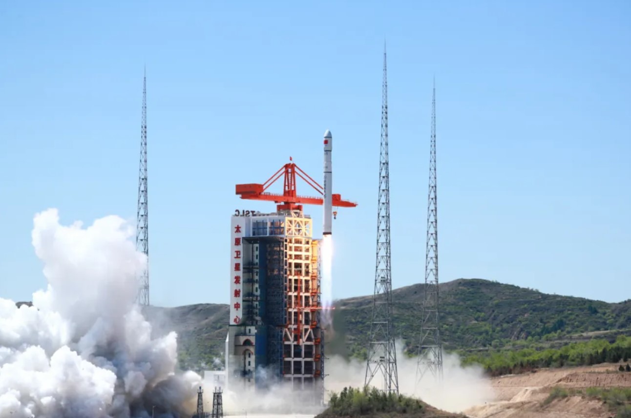
The National Interest report notes that the Taijing-4 03 is believed to be privately made and part of a “five-satellite constellation” used nominally for scientific research and environmental surveys. It comes equipped with synthetic aperture radar (SAR) and AI processors for rapid detection and identification of targets at sea and airports and real-time image transmission.
China has previously used AI to enhance significantly the capabilities of its commercial satellites, enabling them to become powerful intelligence, surveillance and reconnaissance (ISR) assets.
In April 2022, Asia Times reported that China had equipped its Jilin-1 commercial Earth observation satellite with AI that allows it to serve as a powerful spy platform, achieving a 95% precision rate in identifying small objects, seven times greater than the satellite’s previous technology.
The AI can reportedly track moving objects even if they turn sharply or disappear into a tunnel. Traditional satellite AI assumes it made a mistake when losing track of a target, resulting in a mere 14% success rate when analyzing satellite video.
The new AI estimates a moving target’s direction based on experience and continues tracking it based on the most likely direction it would take. The AI can recapture the target as soon as it reappears and works even better from space. By 2025, China plans to launch the entire constellation of 138 Jilin-1 satellites in orbit.
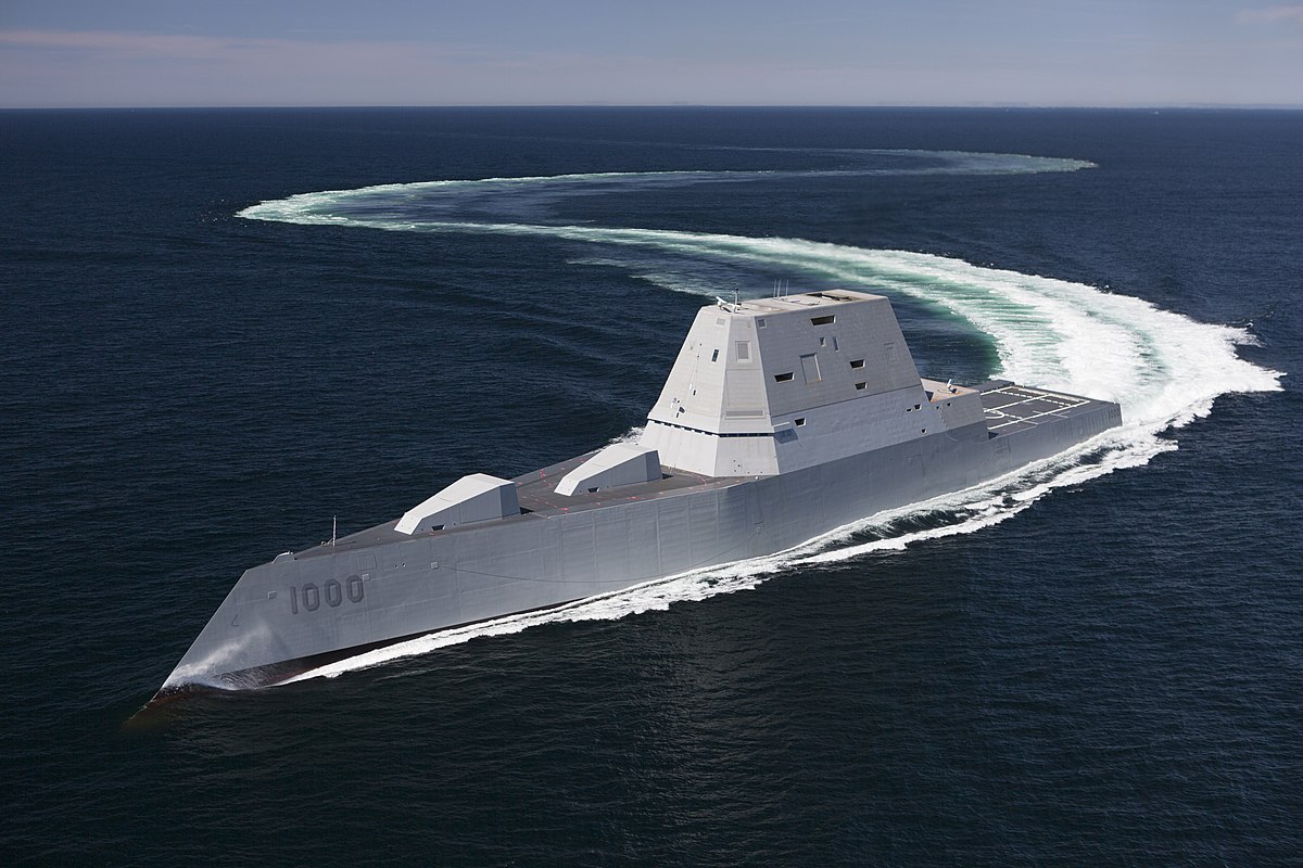
In May 2022, the South China Morning Post (SCMP) reported that a Chinese AI-powered satellite detected and tracked the USS Harry S Truman aircraft carrier during a state transit drill off the coast of Long Island, New York, providing Beijing real-time coordinates of the carrier’s location.
The SCMP report notes that the satellite’s AI could process high-definition images rapidly, identifying military assets with minimal computational resources. It says that despite limitations in space, including processing power and harsh conditions, Chinese scientists have made breakthroughs in AI “weight reduction” and chip resilience.
In a February 2023 Epoch Times article, Mike Fredenburg notes that these capabilities imply that China can now scan vast swathes of the ocean to automatically detect and identify ships, provide real-time targeting data to missile launch facilities and significantly improve its ability to maintain the “kill chains” necessary to attack carriers and other warships at sea.
China's AI-powered satellites imperil US aircraft carriers - Asia Times
China’s Taijing-4 03 radar imaging satellite has recently captured detailed images of the US Navy's critical Naval Station Norfolk, underscoring its
asiatimes.com
The National Interest report notes that the Taijing-4 03 is believed to be privately made and part of a “five-satellite constellation” used nominally for scientific research and environmental surveys. It comes equipped with synthetic aperture radar (SAR) and AI processors for rapid detection and identification of targets at sea and airports and real-time image transmission.
China has previously used AI to enhance significantly the capabilities of its commercial satellites, enabling them to become powerful intelligence, surveillance and reconnaissance (ISR) assets.
In April 2022, Asia Times reported that China had equipped its Jilin-1 commercial Earth observation satellite with AI that allows it to serve as a powerful spy platform, achieving a 95% precision rate in identifying small objects, seven times greater than the satellite’s previous technology.
The AI can reportedly track moving objects even if they turn sharply or disappear into a tunnel. Traditional satellite AI assumes it made a mistake when losing track of a target, resulting in a mere 14% success rate when analyzing satellite video.
The new AI estimates a moving target’s direction based on experience and continues tracking it based on the most likely direction it would take. The AI can recapture the target as soon as it reappears and works even better from space. By 2025, China plans to launch the entire constellation of 138 Jilin-1 satellites in orbit.
In May 2022, the South China Morning Post (SCMP) reported that a Chinese AI-powered satellite detected and tracked the USS Harry S Truman aircraft carrier during a state transit drill off the coast of Long Island, New York, providing Beijing real-time coordinates of the carrier’s location.
The SCMP report notes that the satellite’s AI could process high-definition images rapidly, identifying military assets with minimal computational resources. It says that despite limitations in space, including processing power and harsh conditions, Chinese scientists have made breakthroughs in AI “weight reduction” and chip resilience.
In a February 2023 Epoch Times article, Mike Fredenburg notes that these capabilities imply that China can now scan vast swathes of the ocean to automatically detect and identify ships, provide real-time targeting data to missile launch facilities and significantly improve its ability to maintain the “kill chains” necessary to attack carriers and other warships at sea.